Workshop with Tamme van der Wal (AeroVision) based on examples of market needs met with Copernicus satellite data sources for agrifood market.
February 21st, 2024, 10:00 A.M. – 17:00
at Visoriai Information Technology Park, Mokslininkų str. 2A, Vilnius
Designed for startups, teams, individuals looking for better understanding of business opportunities and exploring use of data analytics
and visualisation in a specific market.
Agenda
9:30 Welcome coffe and registration
10:00 Welcome Adress Geda Daškevičiūtė – Lazauskienė (ESA BIC Lithuania Manager)
10:00 – 11:30
I. The space part:
- 50 years of Earth Observation for land and agriculture
- USP of satellite data (global, objective, repetitive, independent, remote)
- Sensor types: Visible, NIR, Radar, Thermal, Lidar, …
- Active/passive/multi/hyper/modal
- 4Ms: Measuring – Mapping – Monitoring – Managing
- Satellites vs airplanes and drones
- Clouds, daylight, … etc.
- Satellite Navigation, beyond “Clinton’s order” to HAS and NMA
- GPS / Galileo / Glonass
- EGNOS / PPP / HAS
- RTK
- Promotion of satellite data use (ESA / EUSPA)
- Upstream and downstream
II. Space applications for agriculture, from ‘global’ to ‘local’:
- Land use monitoring and food security
- Anomalies, seasonal
- Administration and control of EU Common Agricultural Policy
- Control with Remote Sensing (CAPI)
- Agricultural Monitoring System
- Harvest logistics and food chains
- Several applications
- Precision agriculture
- Scouting
- Task maps
- Stress monitoring / yield prediction
- Soil monitoring
- Soil Health
- CSRD
11:30 Coffe break
11:45 – 13:00 A stakeholder view on food and agriculture (and roles and interests)
A discourse on digitalisation and data:
- Software, data, standards
- Open data / commercial data / FAIR
- Robotics, IoT, AI, big data, … EU Data Act
- 5As: Available, Accessible, Applicable, Acceptable, Affordable
- Resolution, Frequency, Latency,
Review of relevant data sources.
13:00-14:00 Lunch break
14:00 – 15:45 Teamwork
- Build the teams (15 min)
- Explain the exercise (15 min)
- IDEA : Value Proposition, no slide pitch, feedback
- PRODUCT/SERVICE : approach with focus on data
15:45 Coffee break
16:00 – 17:00 Full Pitch (NABC), feedback
Bonus: Teams completing hands-on exercise will qualify for follow-up online individual consultation on their specific solution (costs borne by ESA BIC LT).
The event is free, registration is required.
Register here
About speaker
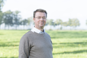 |
Tamme van der Wal has a passion for geospatial data and always looks for opportunities to help organisations to innovate and to make better and broader use of all kinds of geospatial data and technologies. Over the years, he has been working in different roles and affiliations on the use of satellite data (both navigation and earth observation) in particular for agriculture, from European Commission to farmers. Tamme is also assisting all kinds of organisations in developing research and innovation strategies and human capital agendas, and in scaling innovations. Tamme is 56 years old, married, two sons, and prefers to spend his spare time on his sailing boat.
Workshop organiser: European Space Agency Business Incubation Centre Lithuania.
ESA BIC Lithuania operated by Visoriai Information Technology Park and supports entrepreneurs with a space-based business idea and help them develop their product while getting their company off the ground.
